 راهنمای گردشگری راهنمای گردشگری و سفر
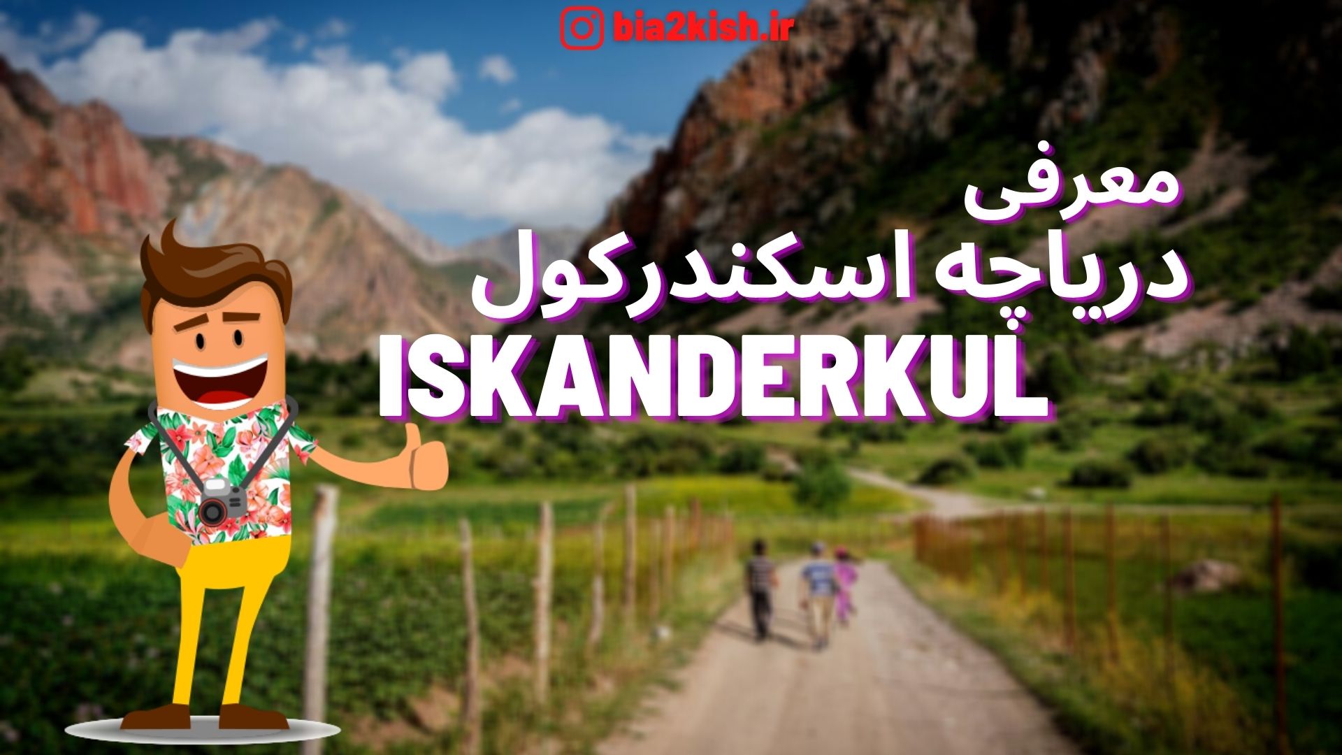
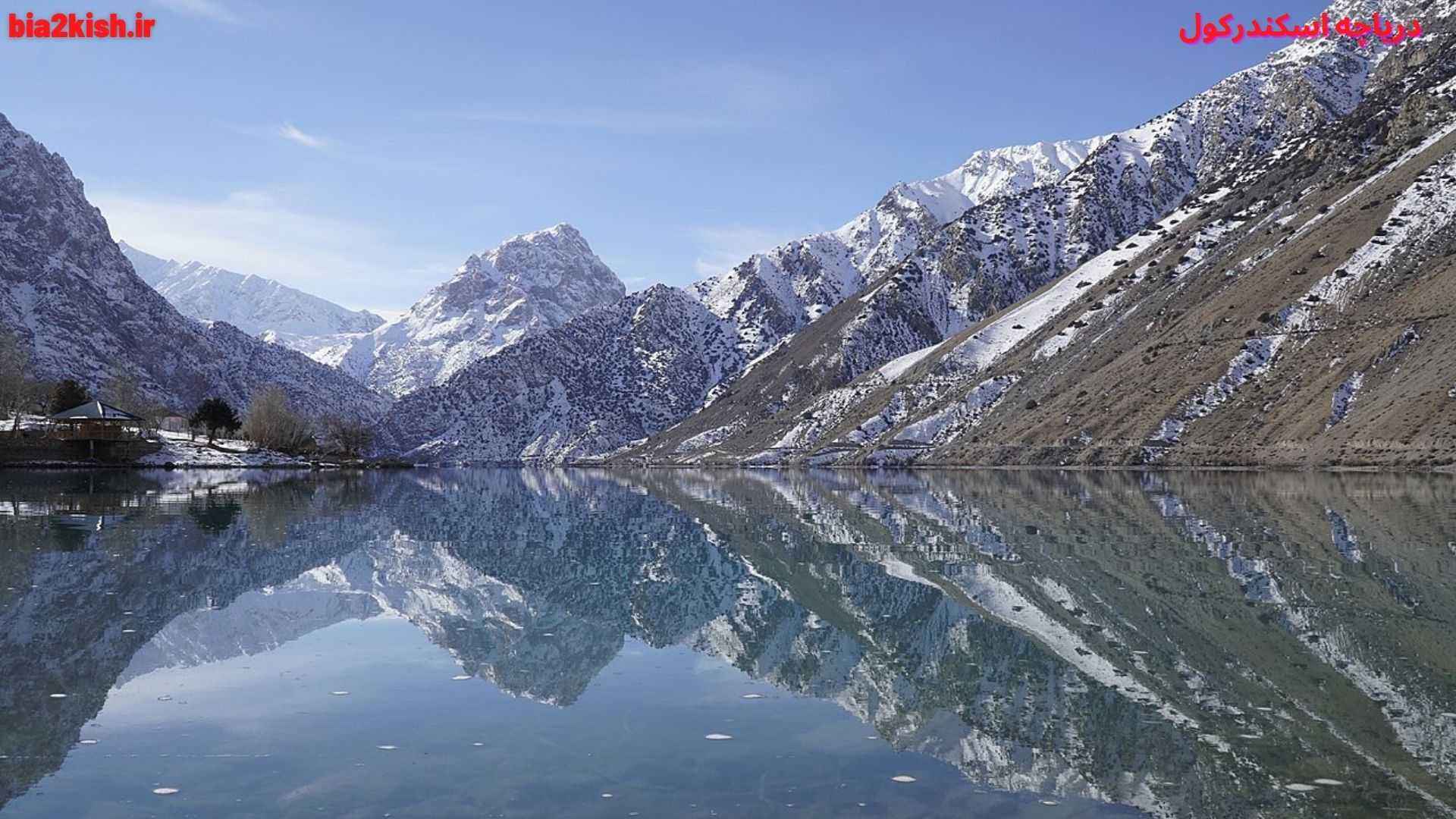
دریاچه اسکندرکول یکی از جاذبه های گردشگری کشور تاجیکستان می باشد.
که دراین بخش از راهنمای گردشگری قصد داریم،
این جاذبه گردشگری را به شما توریست های گرامی معرفی کنیم.
معرفی دریاچه اسکندرکول (Iskanderkul)
دریاچه اسکندرکول نام دریاچهای است.
در شمال باختری کشور تاجیکستان.
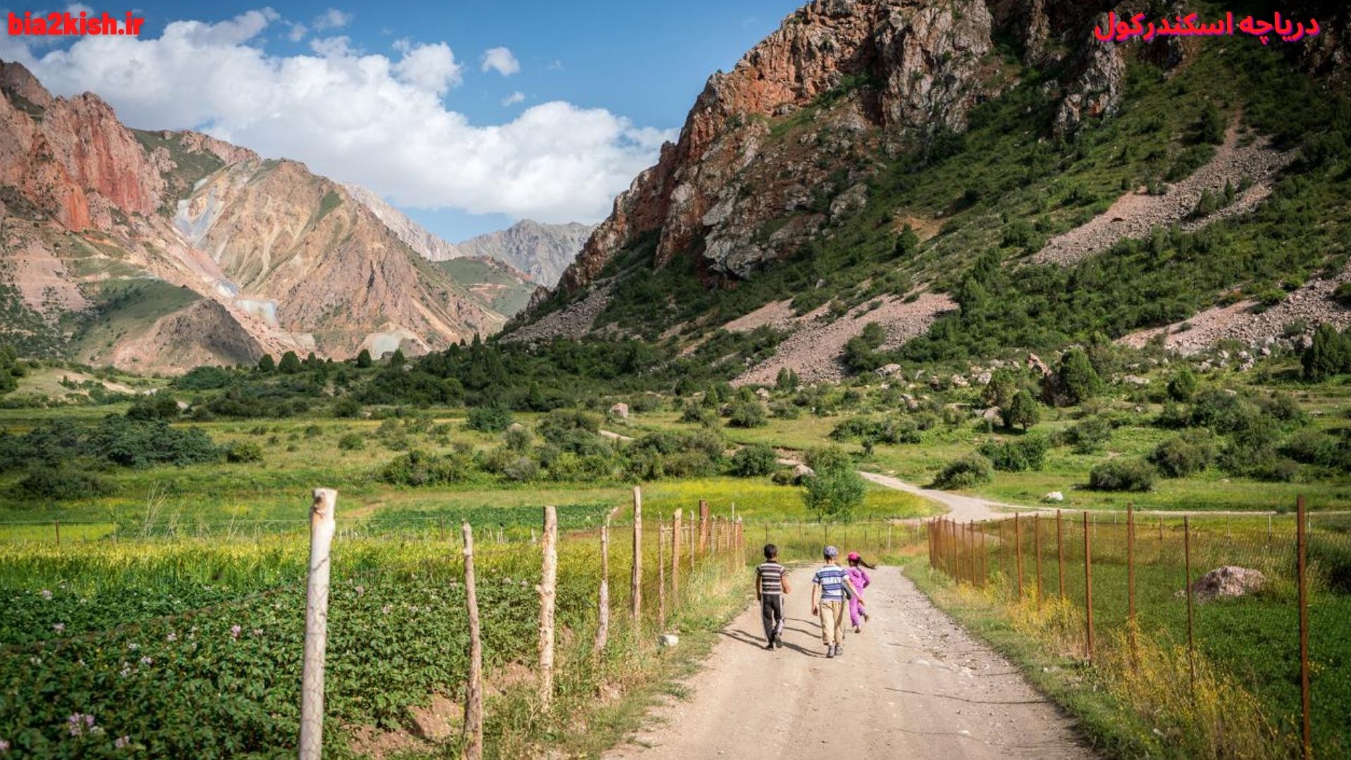
این دریاچه در منطقهٔ موسوم به کوهستان فان، که منطقهای گردشگری است واقع شدهاست.
این کوهستان در رشتهکوه حصار قرار گرفته و بخشی از استان سغد تاجیکستان است.
فاصلهٔ دریاچه اسکندرکول از شهر دوشنبه پایتخت تاجیکستان تقریباً ۱۳۰ کیلومتر است.
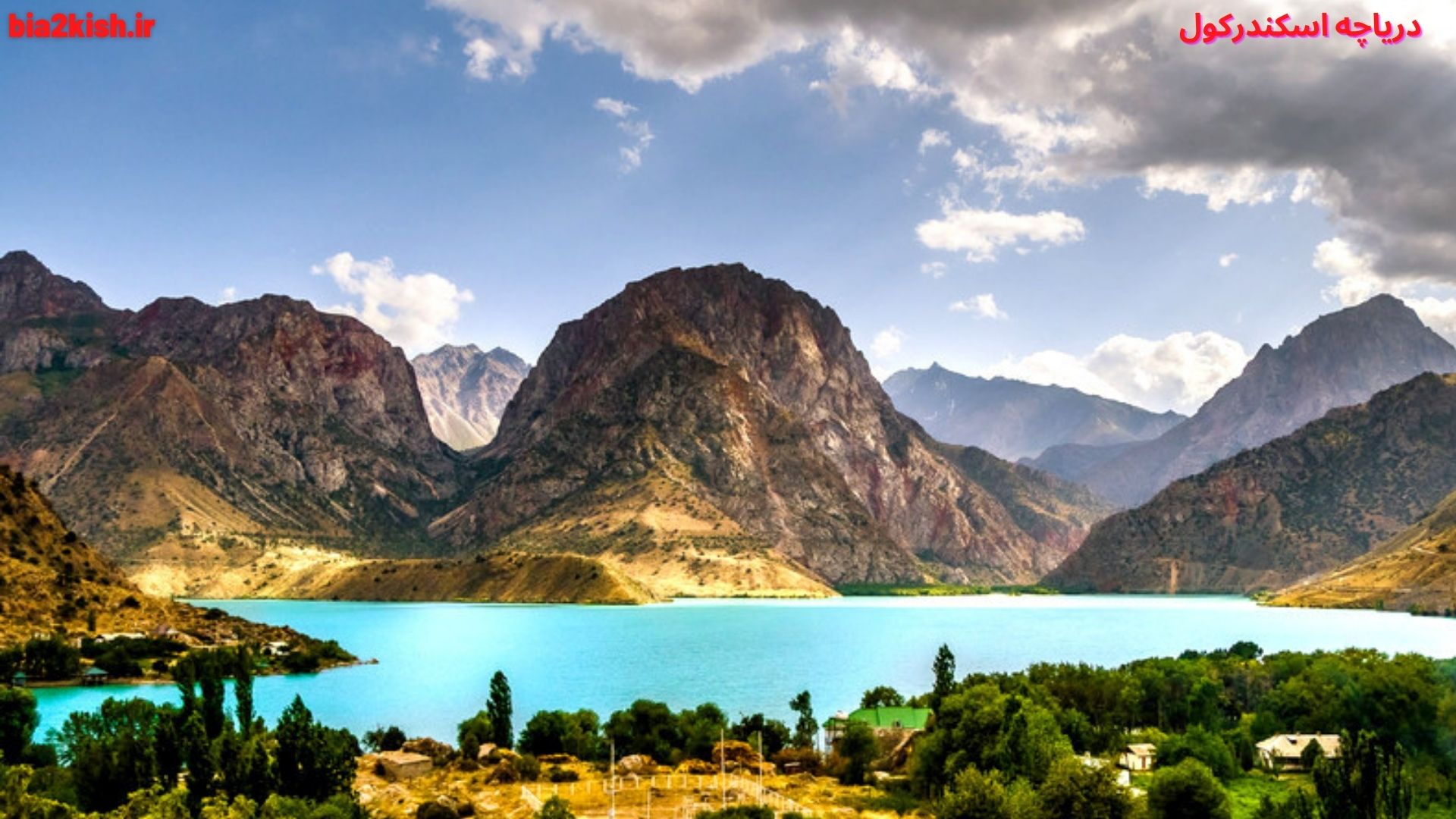
این دریاچه با دو و نیم کیلومتر درازا و یک کیلومتر پهنا و حدود ۷۲ متر ژرفا دیدنیترین دریاچههای این کوهستان بهشمار میآید.
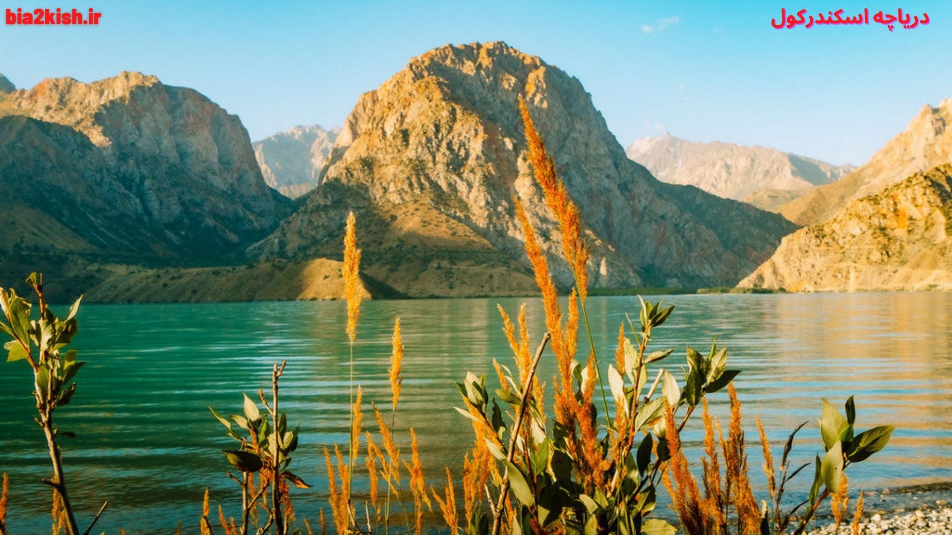
تنوع درخت و بوتههای پیرامون اسکندرکول از مهمترین انگیزههای سفر گردشگران به این منطقه است.
خرگوش، روباه، گرگ، خرس سیاه، بز کوهی، پلنگ و پرندگانی چون بوقلمون کوهی، کبک، لاشخور و بلدرچین از جانوران این منطقه هستند.
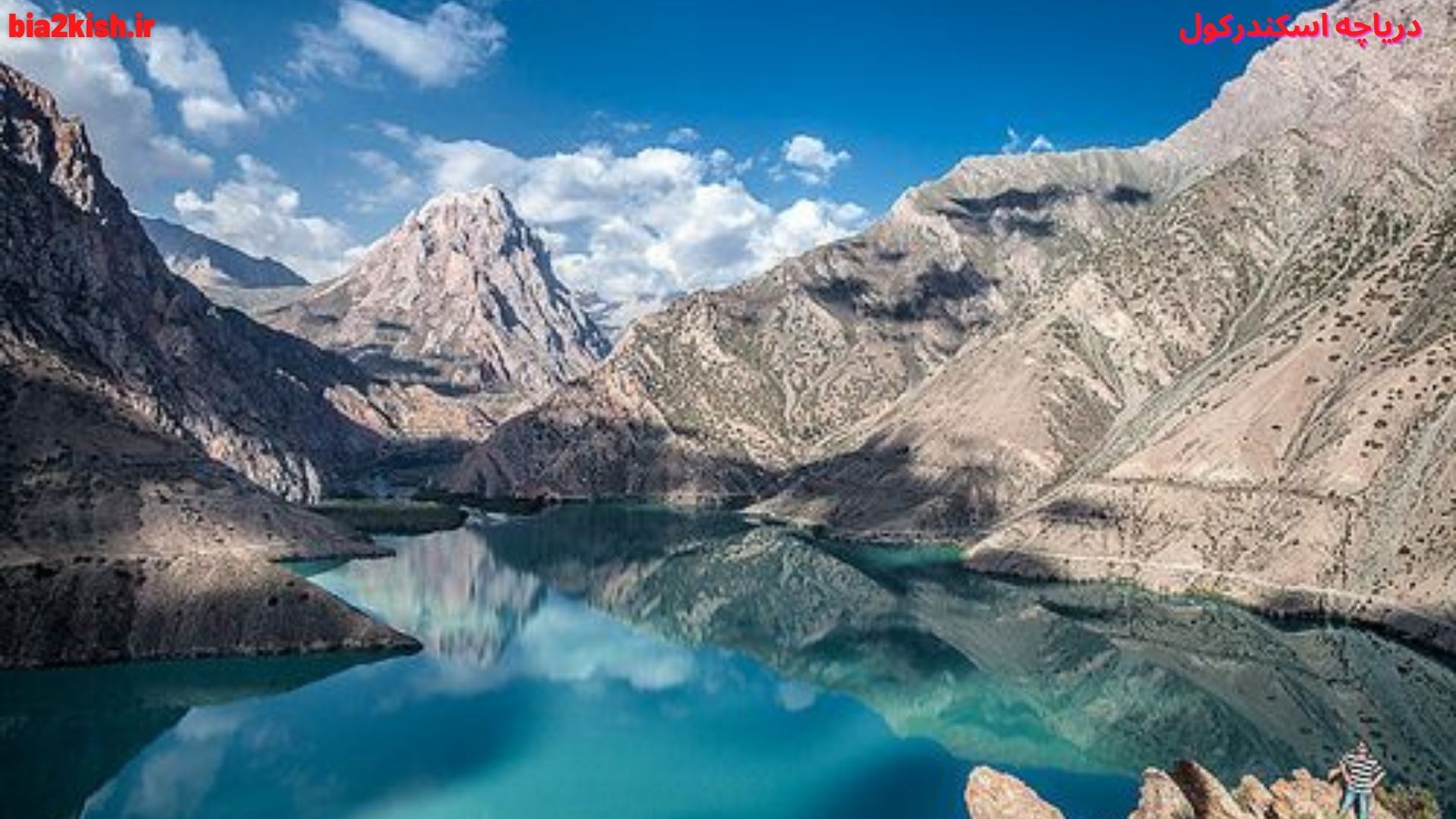
پیدایش دریاچه
دانشمندان بر این باورند که اسکندرکول چندین هزار سال پیش بر اثر زمینلغزه در ارتفاع ۲٬۲۵۵ متری پدید آمده است.
به باور آنها فروریختن کوه و بند آمدن رودخانه سرتاغ باعث پدید آمدن این دریاچه شده است.
رودهای سریمه و سرتاغ و هزارمیخ از شمال و غرب و جنوب به دریاچه سرازیر میشوند
و تنها از شرق دریاچه، رود موسوم به «اسکندردریا» به بیرون میریزد.
آبشار بزرگی هم در طول این رود قرار دارد.
در کرانههای بریدهبریده و در فراز کنارههای دریاچه خطهای سیاهی به چشم میخورد که باید خط آبگیر دریاچه درروزگار کهن باشد.
بلندترین و کهنترین این خطها ۱۱۷ متر از سطح کنونی آب دریاچه ارتفاع دارد.
اسکندرکول تنها دریاچهٔ کوهستان فان نیست. در این حوزه حدود سی دریاچه در دورههای مختلف پدید آمدهاند.
دانستنی های دریاچه
موقعیت دریاچه » رشتهکوه حصار، کوهستان فان
مختصات دریاچه » ۳۹°۰۴′۲۱″ شمالی ۶۸°۲۱′۵۹″ شرقیمختصات: ۳۹°۰۴′۲۱″ شمالی ۶۸°۲۱′۵۹″ شرقی
گونه دریاچه » یخچالی
درونشارشهای کلان سرتاغ، هزارمیخ، سریمه
برونشارشهای کلان اسکندردریا
کشورهای حوضه دریاچه » تاجیکستان
مساحتِ رو ۳٫۴ کیلومترمربع
بیشترین عمق دریاچه » ۷۲ متر
ارتفاع سطح دریاچه » ۲٬۱۹۵ متر
Iskanderkul
Iskanderkul is a mountain lake of glacial origin in Tajikistan’s Sughd Province. It lies at an altitude of 2,195 metres (7,201 ft) on the northern slopes of the Gissar Range in the Fann Mountains. Triangular in shape, it has a surface area of 3.4 square kilometres (1.3 sq mi) and is up to 72 metres (236 ft) deep. Formed by a landslide that blocks the Saratogh river, the outflow of the lake is called the Iskander Darya, which joins the Yaghnob River to form the Fan Darya, a major left tributary of the Zeravshan River.
۱۳۴ km from Dushanbe and 23 km from the Dushanbe—Khujand road, Iskanderkul is a popular tourist destination
The lake takes its name from Alexander the Great’s passage in Tajikistan: Iskander is the Persian pronunciation of Alexander, and kul means lake in many Turkic languages
iskanderkul in winter
Birds
A 300 square kilometres (120 sq mi) tract of land including the lake and surrounding mountains has been designated a nature reserve. As well as the lake itself, habitats found in the reserve include rivers, water meadows, broad-leaved and juniper forests, mountain shrubland and sub-alpine meadows.
Over half of the reserve, comprising 177 square kilometres (68 sq mi), has been identified by BirdLife International as an Important Bird Area because it supports significant numbers of the populations of various bird species, either as residents, or as breeding or passage migrants. These include Himalayan snowcocks, saker falcons, cinereous vultures, yellow-billed choughs, Hume’s larks, sulphur-bellied warblers, wallcreepers, Himalayan rubythroats, white-winged redstarts, white-winged snowfinches, alpine accentors, rufous-streaked accentors, brown accentors, water pipits, fire-fronted serins, plain mountain-finches, crimson-winged finches, red-mantled rosefinches and white-winged grosbeaks.
References
Historical Dictionary of Tajikistan, Kamoludin Abdullaev and Shahram Akbarzadeh. The Scarecrow Press, Inc., Lanham, Maryland, and London. 2002, p. 95.
“Iskanderkul and Sarytag”. Caravanistan. Retrieved 2020-02-26.
“Iskanderkul lake and mountains”. Important Bird Areas factsheet. BirdLife International. 2013. Retrieved 2013-03-31.